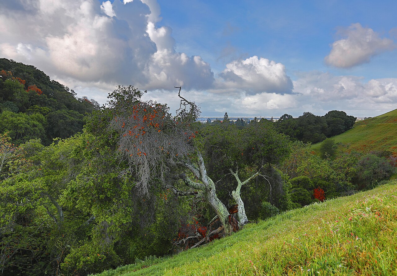
Dry Creek Pioneer Regional Park
Union City, Alameda County, CA
- Size
- 1,675 acres Source
- Managed by
- East Bay Regional Park District
About Dry Creek Pioneer Regional Park
Dry Creek Pioneer Regional Park began as the 1,626-acre Dry Creek Ranch, owned by Edith, Mildred, and Jeanette Meyers, three Alameda sisters active in local charities, who donated the land to the Park District in 1979. Together with neighboring Garin Regional Park, another former 19th-century ranch, it forms more than 5,800 acres of open space, with trails through narrow valleys and rolling hills with views across the Bay Area.
The Meyers Cottage and its restored two-acre garden, home to nearly 200 native and exotic plants, sit at the end of May Road off Mission Boulevard in Union City. The Park District plans to open the cottage for events and a small visitor center. The neighboring iris garden usually opens for about two months each spring, Thursday through Sunday. The May Road lot doubles as the southern trailhead and has disabled-accessible parking.
Gate hours start at 8 a.m. and close as late as 9 p.m. in midsummer or 6 p.m. in winter. Parking is $5 per vehicle when the kiosk is staffed, $5 per trailered vehicle, and $25 per bus.
Based on Dry Creek Pioneer Regional Park official information, checked Oct 15, 2026.
Know before you go
Dry Creek Pioneer Regional Park covers 1,675 acres in Union City, Alameda County. 9 named trails add up to about 12.2 miles inside the park; the longest is High Ridge Loop Trail at 4.4 miles, and High Ridge Loop Trail has the most up and down (about 1,923 feet). Mapped trails range from 127 to 1,173 feet in elevation. OpenStreetMap shows 1 parking area, including Dry Creek Pioneer Staging Area, plus 1 restroom and 1 drinking fountain. The closest mapped bus stop is Mission Boulevard & Whipple Road (routes 99, 801), about 140 feet from the park.
Facilities
- Drinking Water
- Restrooms
Facility details: OpenStreetMap
Dry Creek Pioneer Regional Park at a glance
- PParking · 1: Dry Creek Pioneer Staging Area
- WCRestrooms · 1
- WDrinking water · 1
- Named trails · 9
© OpenStreetMap · CPAD · About this map
Trails
| Trail | Mapped length | Elevation | Surface & uses |
|---|---|---|---|
| High Ridge Loop Trail | 4.4 mi | 1,923 ft up & down140–1,173 ft | UnpavedBikesHorses |
| Tolman Peak Trail | 1.9 mi | 854 ft up & down194–1,072 ft | UnpavedBikesHorses |
| Meyers Ranch Trail | 1.6 mi | 635 ft up & down154–939 ft | BikesHorses |
| Pioneer Trail | 1.2 mi | 644 ft up & down241–659 ft | No bikesHorses |
| South Fork Trail | 0.9 mi | 535 ft up & down293–969 ft | UnpavedBikesHorsesNo bikes |
| F.D. 143 | 0.8 mi | 511 ft up & down206–703 ft | BikesHorses |
| Gossip Rock Trail | 0.7 mi | 200 ft up & down1,007–1,125 ft | Unpaved |
| Dry Creek Trail | 0.6 mi | 108 ft up & down224–309 ft | UnpavedNo bikesHorses |
| May Trail | 0.1 mi | 25 ft up & down127–161 ft | UnpavedBikesHorses |
Getting to Dry Creek Pioneer Regional Park by bus
- Mission Boulevard & Whipple Road · Routes 99, 801 · 140 ft from the park
- 2nd Street & D Street · 330 ft from the park
- Mission Boulevard & F Street · Routes 99, 801 · 930 ft from the park
- 2nd Street & F Street · 980 ft from the park
Stops within a quarter mile of Dry Creek Pioneer Regional Park; confirm times with the transit agency.
Compared with nearby parks
Among the 45 other parks in this guide within 10 miles, Dry Creek Pioneer Regional Park is number 3 of 46 by size at 1,675 acres. 3 nearby parks have more mapped trail mileage than its 12.2 miles.
Closest places for what Dry Creek Pioneer Regional Park doesn't list:
- Off-Leash Area: San Lorenzo Community Park (7.8 mi)
- Playground: Bidwell Park (1.7 mi)
- Swimming: Quarry Lakes Regional Recreation Area (3.1 mi)
Rules & reservations
Official park page- Dogs
At Dry Creek Pioneer Regional Park: leash in developed areas, under the East Bay Regional Park District dog rules. Source
Gate hours change through the year; check the posted schedule. Park curfew 10 p.m. to 5 a.m.
Map & directions
550 May Road, Union City, CA 94587
Nearby parks
Straight-line distanceContinue exploring
Alameda County parksSources & verification
Last verified: Oct 15, 2026- California Protected Areas Database (CPAD) 2026aname, county, agency, access, acres
- East Bay Regional Park District dog rulesdogs
- East Bay Regional Park District park pageofficial_url, hours, address, description, fees
- OpenStreetMap facilities and trailsfacilities.drinking-water, facilities.restrooms, trails
- U.S. Census Bureau place boundariescity
- OpenStreetMap: parking, restrooms, water, trailheads, trail lines, and bus stopsvisit
- Terrain Tiles elevation (USGS 3DEP), sampled every 20 m along OpenStreetMap trail linestrails.elevation
- Official park page (summarized in our words)narrative
- Official park page (introduction excerpt)intro