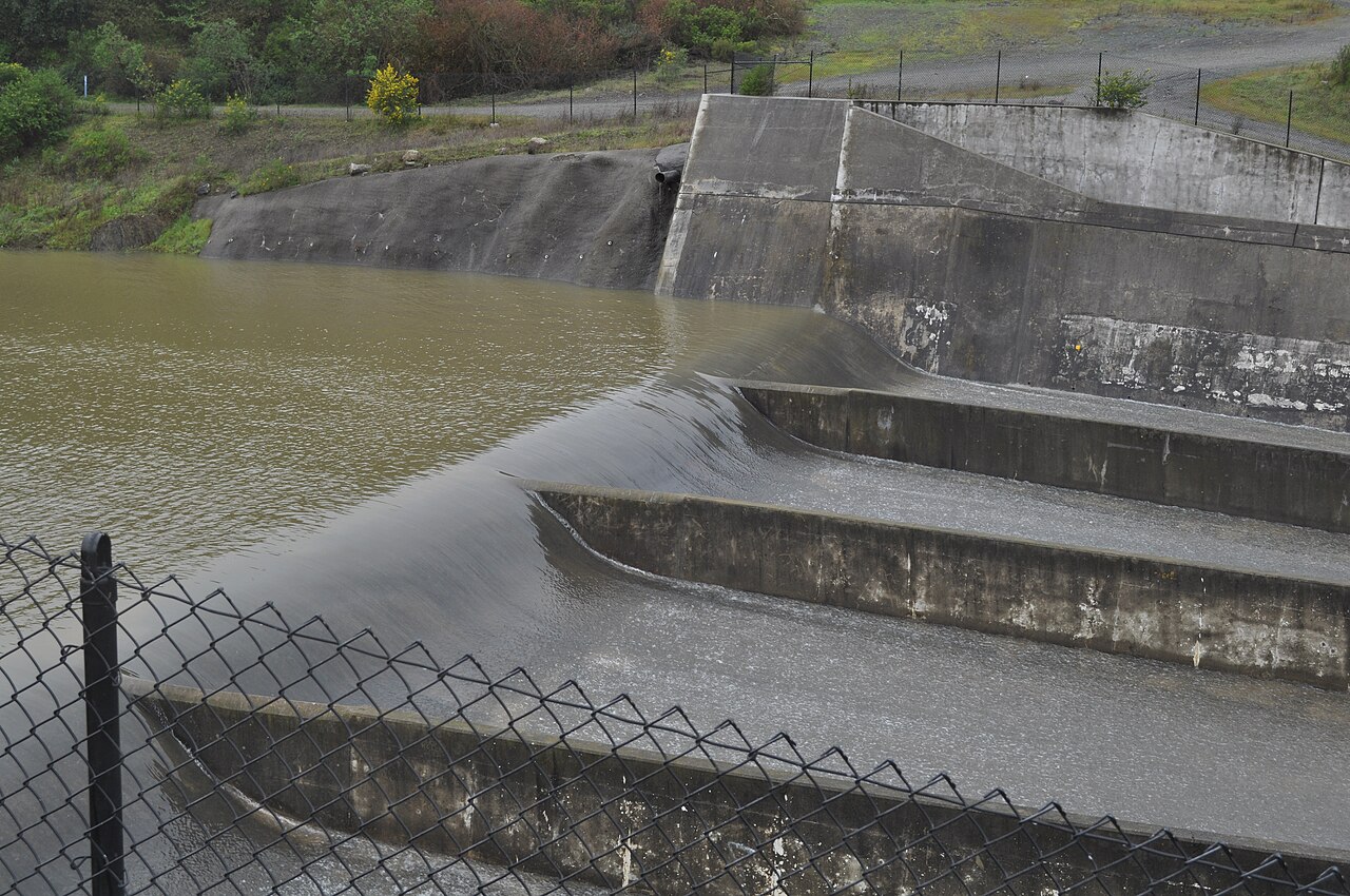
Lexington Reservoir County Park
Los Gatos, Santa Clara County, CA
- Size
- 950 acres Source
- Managed by
- Santa Clara County Parks
About Lexington Reservoir County Park
Activities at Lexington Reservoir County Park revolve around the reservoir and its trails. Two staging areas sit off Alma Bridge Road. The boat launch, about 0.3 miles from the dam, has portable toilets and first-come, first-served picnic tables, and it connects to the Jones Trail and Saint Joseph's Hill Open Space Preserve. Miller Point, about 1.3 miles from the dam, has a parking area, a picnic area, and trail access, and it is a popular place to fish. Swimming is prohibited.
When boating is in season, the reservoir is open to boats on weekends and holidays from 8 a.m. to 30 minutes before sunset. Only boats without gas motors may launch, and only when the water level allows use of the ramp; boaters pay launch and inspection fees. The county also publishes a guide to eating fish caught in the reservoir.
Hiking, biking, and picnicking round out the activities, and leashed dogs are welcome. Day use runs from 8 a.m. to sunset, with a vehicle entry fee collected year-round. The launch ramp entrance has paid parking and restrooms, while Miller Point has free parking and restrooms. Park land west of Highway 17, between Beardsley and Montevina roads, is closed to the public, with future recreational use planned.
Based on Lexington Reservoir County Park official information, checked Oct 18, 2026.
Know before you go
Lexington Reservoir County Park covers 950 acres in Los Gatos, Santa Clara County. Closing follows the sun here: sunset at Lexington Reservoir County Park is around 4:51 p.m. in mid-December, 7:14 p.m. in mid-March, 8:29 p.m. in mid-June, and 7:17 p.m. in mid-September. 5 named trails add up to about 2.5 miles inside the park; the longest is Priest Rock Trail at 1.2 miles, and Priest Rock Trail has the most up and down (about 541 feet). Mapped trails range from 528 to 1,213 feet in elevation. OpenStreetMap shows 11 parking areas, including Douglas B. Miller Memorial Point parking (30 spaces), plus 3 restrooms.
Facilities
- Boat Launch
- Historic Site
- Picnic Area
- Restrooms
- Fishing
Facility details: OpenStreetMap, official park information
Lexington Reservoir County Park at a glance
- PParking · 11: Douglas B. Miller Memorial Point parking (30 spaces)
- WCRestrooms · 3
- Named trails · 5
© OpenStreetMap · CPAD · About this map
Trails
| Trail | Mapped length | Elevation | Surface & uses |
|---|---|---|---|
| Priest Rock Trail | 1.2 mi | 541 ft up & down749–1,213 ft | UnpavedBikesHorses |
| Limekiln Trail | 0.5 mi | 207 ft up & down678–805 ft | Unpaved |
| Jones Trail | 0.4 mi | 219 ft up & down679–861 ft | UnpavedBikesHorses |
| Los Gatos Creek Trail | 0.2 mi | 127 ft up & down528–672 ft | PavedBikes |
| Alma Bridge - Black Creek Connector | 0.2 mi | 9 ft up & down663–671 ft | Unpaved |
Compared with nearby parks
Among the 15 other parks in this guide within 10 miles, Lexington Reservoir County Park is number 8 of 16 by size at 950 acres. 10 nearby parks have more mapped trail mileage than its 2.5 miles.
Closest places for what Lexington Reservoir County Park doesn't list:
- Off-Leash Area: Los Gatos Creek County Park (5.7 mi)
- Playground: Vasona Lake County Park (3.1 mi)
- Camping: Sanborn County Park (4.4 mi)
Rules & reservations
Official park page- Dogs
The park lists dogs (on-leash) among its activities. Source
Boating on weekends and holidays, 8 a.m. to 30 minutes before sunset.
Map & directions
17770 Alma Bridge Road, Los Gatos, CA 95032
Nearby parks
Straight-line distanceContinue exploring
Santa Clara County parks Parks in Los GatosSources & verification
Last verified: Oct 15, 2026- California Protected Areas Database (CPAD) 2026aname, county, agency, access, acres
- Santa Clara County Parks park page (read in a browser)official_url, hours, hours_note, dogs, address, description, facilities.fishing, facilities.picnic-area, fees
- Santa Clara County Parks vehicle entrance feesfees
- OpenStreetMap facilities and trailsfacilities.boat-launch, facilities.historic-site, facilities.restrooms, trails
- Official park page (city in the park's mailing address; the park lies outside Census place boundaries)city
- OpenStreetMap: parking, restrooms, water, trailheads, trail lines, and bus stopsvisit
- Terrain Tiles elevation (USGS 3DEP), sampled every 20 m along OpenStreetMap trail linestrails.elevation
- Official park page (summarized in our words)narrative