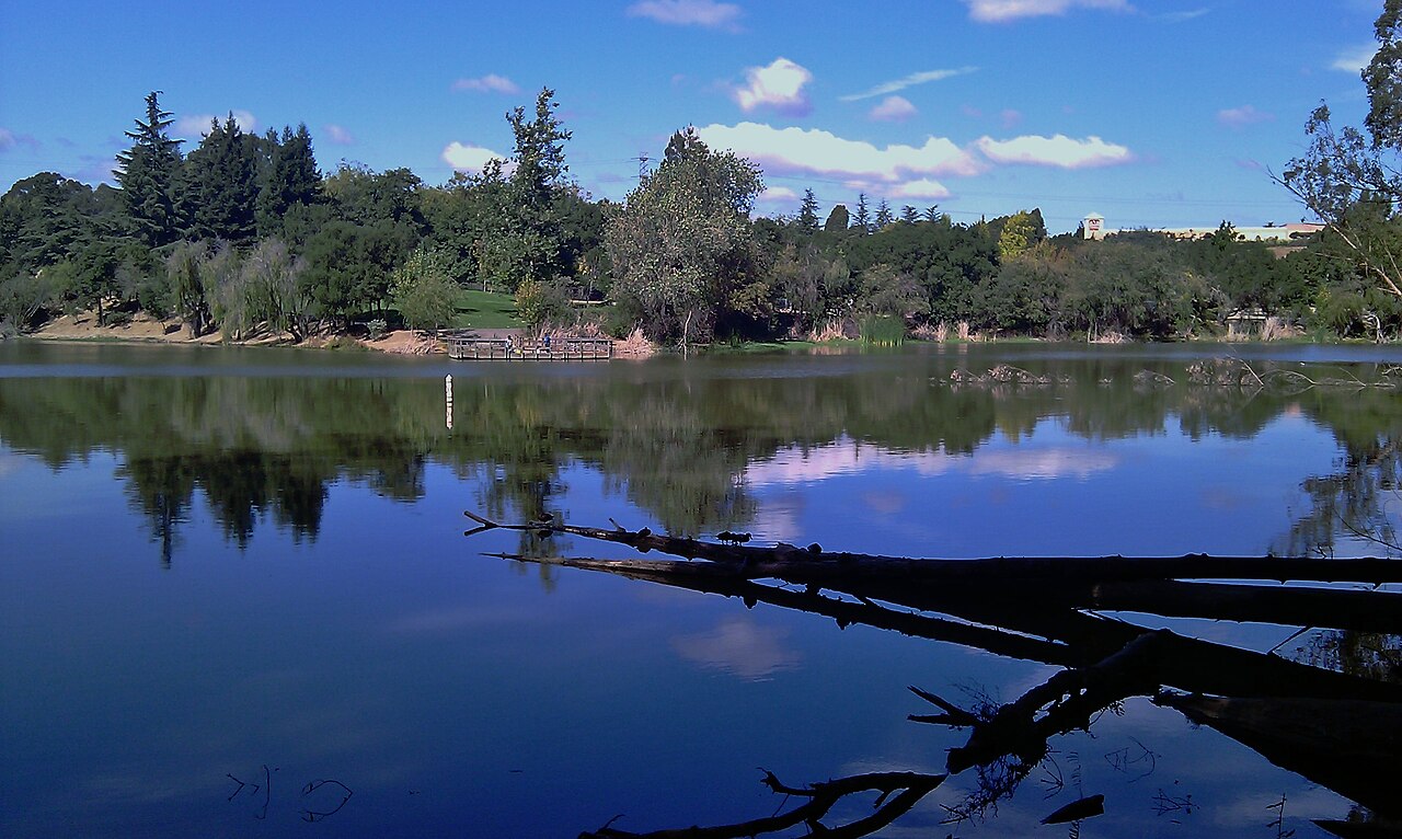
Don Castro Regional Recreation Area
Fairview, Alameda County, CA
- Size
- 95 acres Source
- Swimming
- Lagoon reopens in 2027 Source
- Managed by
- East Bay Regional Park District
About Don Castro Regional Recreation Area
Don Castro is a compact 101-acre park on the boundary between Hayward and Castro Valley, built around a swim lagoon created in 1964 when the Alameda County Flood Control and Water Conservation District dammed San Lorenzo Creek. The lagoon is filled with filtered, chlorinated EBMUD water and has a large roped-off shallow area for children; it is scheduled to reopen for the 2027 swim season. Only ADA-trained service dogs are allowed in the swim area. The neighboring San Lorenzo Creek Reservoir is closed to boating, swimming, and any body contact, including dogs.
Anglers 16 and older need a state fishing license, but no District permit. Trails connect to the Bay Area Ridge Trail, the Chabot-to-Garin Trail, and more than five miles of paths in Five Canyons Open Space. First-come picnic sites and reservable group areas sit outside the swim complex.
The park has wheelchair-accessible restrooms, drinking water, and disabled parking, and free beach wheelchairs can be arranged through the park office; staff bring the chair to the beach and show how it works. Parking is $5 per vehicle on weekends and holidays from June through September, with no fee collected October through May.
Based on Don Castro Regional Recreation Area official information, checked Oct 15, 2026.
Know before you go
Don Castro Regional Recreation Area covers 95 acres in Fairview, Alameda County. 3 named trails add up to about 0.6 miles inside the park; the longest is Bay Area Ridge Trail at 0.3 miles, and Bay Area Ridge Trail has the most up and down (about 90 feet). Mapped trails range from 176 to 302 feet in elevation. OpenStreetMap shows 2 parking areas, plus 4 restrooms. The closest mapped bus stop is Kelly Street & Mossy Rock Drive (routes 95), about 980 feet from the park.
Facilities
- Picnic Area
- Restrooms
Facility details: OpenStreetMap
Don Castro Regional Recreation Area at a glance
- PParking · 2
- WCRestrooms · 4
- Named trails · 3
© OpenStreetMap · CPAD · About this map
Trails
| Trail | Mapped length | Elevation | Surface & uses |
|---|---|---|---|
| Bay Area Ridge Trail | 0.3 mi | 90 ft up & down248–302 ft | UnpavedBikes |
| Twilight Trail | 0.2 mi | 74 ft up & down176–263 ft | |
| Ridgetop Trail | 0.1 mi | 39 ft up & down243–292 ft |
Getting to Don Castro Regional Recreation Area by bus
- Kelly Street & Mossy Rock Drive · Routes 95 · 980 ft from the park
- Kelly Street & Byron Street · Routes 95 · 980 ft from the park
- Eddy Street & Kelly Street · Routes 95 · 1020 ft from the park
- Kelly Street & Prime Avenue · Routes 95 · 1240 ft from the park
Stops within a quarter mile of Don Castro Regional Recreation Area; confirm times with the transit agency.
Compared with nearby parks
Among the 47 other parks in this guide within 10 miles, Don Castro Regional Recreation Area is number 20 of 48 by size at 95 acres. 18 nearby parks have more mapped trail mileage than its 0.6 miles.
Closest places for what Don Castro Regional Recreation Area doesn't list:
- Off-Leash Area: San Lorenzo Community Park (5.3 mi)
- Playground: Lakeridge Park (0.6 mi)
- Swimming: Cull Canyon Regional Recreation Area (2.2 mi)
Rules & reservations
Official park pageOpen until 10 p.m. March–October and 8 p.m. November–February. Park curfew 10 p.m. to 5 a.m.
Map & directions
22400 Woodroe Avenue, Hayward, CA 94541
Nearby parks
Straight-line distanceContinue exploring
Alameda County parksSources & verification
Last verified: Oct 15, 2026- California Protected Areas Database (CPAD) 2026aname, county, agency, access, acres
- East Bay Regional Park District park pageofficial_url, hours, address, description, fees, swimming
- OpenStreetMap facilities and trailsfacilities.picnic-area, facilities.restrooms, trails
- U.S. Census Bureau place boundariescity
- OpenStreetMap: parking, restrooms, water, trailheads, trail lines, and bus stopsvisit
- Terrain Tiles elevation (USGS 3DEP), sampled every 20 m along OpenStreetMap trail linestrails.elevation
- Official park page (summarized in our words)narrative
- Official park page (introduction excerpt)intro