Hermosa Beach
Hermosa Beach, Los Angeles County, CA
- Size
- 92 acres Source
- Swimming
- Lifeguards in daylight hours Source
- Managed by
- LA County Beaches and Harbors
About Hermosa Beach
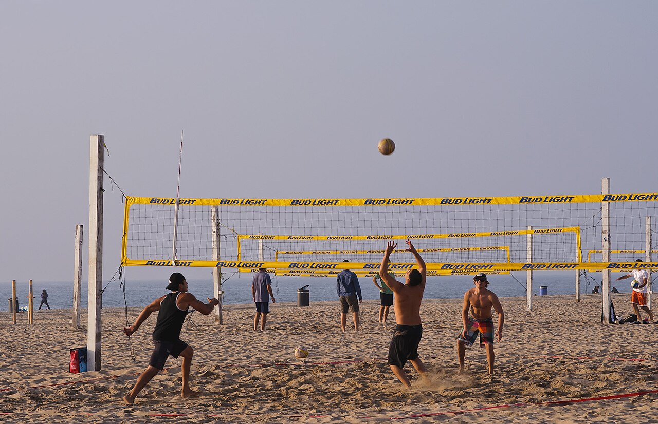
Hermosa Beach is a city-owned beach with almost two miles of ocean frontage, running along Santa Monica Bay until it meets King Harbor in Redondo Beach. It is one of the most popular beaches in Los Angeles County, known for good surf, good swimming areas, and its many volleyball nets, and it hosts volleyball tournaments and surf festivals through the year. Lifeguards are on duty during daylight hours, and beach tennis, diving, surfing, and swimming are all popular.
Facilities include restrooms, showers, a concession stand, playground equipment, beach wheelchairs, and access to the beach bike path, with restaurants nearby. Parking is in lots and metered street spaces, and the beach is served by Commuter Express 438 at Manhattan Avenue and 29th Street and by Beach Cities Transit 109 at Manhattan Avenue and Longfellow.
The land was once part of the 1784 Rancho San Pedro Spanish land grant, later part of Rancho Sausal Redondo, and was covered with grain fields and grazed by sheep. In 1900 developers bought 1,500 acres for $35 an acre and named the development “Hermosa,” Spanish for beautiful. A wooden boardwalk was built along the Strand after a 1901 survey, and most of it was replaced with cement in 1914. The first pier, built of wood in 1904 and reaching 500 feet into the ocean, was partly washed away, and a concrete pier twice its size followed in 1913. Hermosa was mainly a resort town until the 1920s, and its population grew quickly during and after World War II as the aircraft industry expanded.
Based on Hermosa Beach official information, checked Oct 16, 2026.
Know before you go
Hermosa Beach covers 92 acres in Hermosa Beach, Los Angeles County. OpenStreetMap shows 1 parking area, plus 4 restrooms and 2 drinking fountains. The closest mapped bus stop is Hermosa Avenue / Lyndon Street, about 200 feet from the park.
Facilities
- Drinking Water
- Restrooms
- Volleyball
- Swimming
- Playground
Facility details: OpenStreetMap, official park information
Hermosa Beach at a glance
- PParking · 1
- WCRestrooms · 4
- WDrinking water · 2
© OpenStreetMap · CPAD · About this map
Getting to Hermosa Beach by bus
- Hermosa Avenue / Lyndon Street · 200 ft from the park
- Hermosa Avenue / 2nd Street · 200 ft from the park
- Hermosa Avenue / 25th Street · 220 ft from the park
- Hermosa Avenue / 26th Street · 290 ft from the park
Stops within a quarter mile of Hermosa Beach; confirm times with the transit agency.
Compared with nearby parks
Among the 20 other parks in this guide within 10 miles, Hermosa Beach is number 4 of 21 by size at 92 acres.
Closest places for what Hermosa Beach doesn't list:
- Off-Leash Area: Dockweiler State Beach (7.7 mi)
- Splash Pad: Alondra Community Regional Park (3.8 mi)
- Fishing: Manhattan Beach (1 mi)
Rules & reservations
Official park page- Dogs
At Hermosa Beach: not on the beach, under the LA County beach rules. Source
Map & directions
Hermosa Avenue & 33rd Street, Hermosa Beach, CA 90254
Nearby parks
Straight-line distanceContinue exploring
Los Angeles County parks PlaygroundsSources & verification
Last verified: Oct 16, 2026- California Protected Areas Database (CPAD) 2026aname, county, agency, access, acres
- LA County Beaches and Harbors pageofficial_url, address, description, swimming, facilities.swimming, facilities.volleyball, facilities.playground, facilities.restrooms
- LA County beach rulesdogs
- OpenStreetMap facilities and trailsfacilities.drinking-water
- U.S. Census Bureau place boundariescity
- OpenStreetMap: parking, restrooms, water, trailheads, trail lines, and bus stopsvisit
- Official park page (summarized in our words)narrative
- Official park page (introduction excerpt)intro