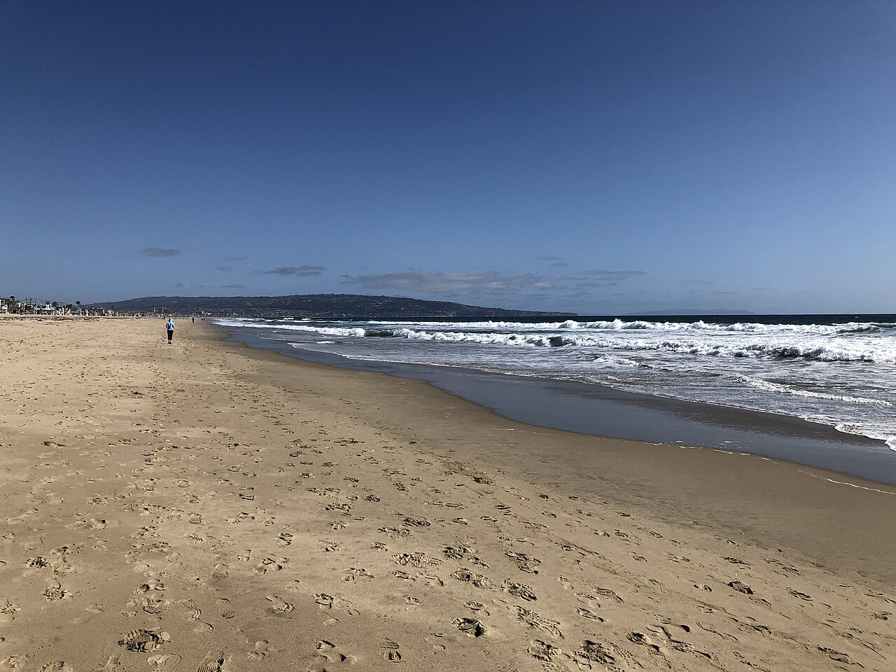
Manhattan Beach
Manhattan Beach, Los Angeles County, CA
- Size
- 96 acres Source
- Swimming
- Lifeguards in daylight hours Source
- Managed by
- LA County Beaches and Harbors
About Manhattan Beach
Manhattan Beach stretches for more than two miles of sand, about 115 acres, split in the middle by a 900-foot pier at the end of Manhattan Beach Boulevard, where fishing is allowed year-round. The north end, called El Porto, is a busy surf spot with lessons available, and volleyball nets line the sand all the way south to Hermosa Beach; the AVP Manhattan Beach Open draws big crowds every summer. Lifeguards are on duty in daylight, and the beach has restrooms, showers, a playground, beach wheelchairs, ramps and stairs to the sand, and access to the beach bike path. There are more than 450 public parking spaces in lots and on the street.
The area's history is tied to its sand. The first known residents, the Engnovangas Rancheria people, fished for corbina in the shallows. The land later belonged to Rancho Sausal Redondo, and in 1902 developers reportedly settled on the name "Manhattan" with a coin toss. Early beach cottages had no gas or electricity, and dunes 50 to 70 feet high had to be leveled; for nearly a decade in the late 1920s, Manhattan Beach sand was shipped by rail and barge to Waikiki. Some dunes survive at Sand Dune Park on the north end.
Commuter Express 438 and Beach Cities Transit 109 stop along Manhattan Avenue near the beach.
Based on Manhattan Beach official information, checked Oct 16, 2026.
Know before you go
Manhattan Beach covers 96 acres in Manhattan Beach, Los Angeles County. 1 named trail add up to about 1.8 miles inside the park; the longest is South Bay Bike Path at 1.8 miles, and South Bay Bike Path has the most up and down (about 25 feet). Mapped trails range from 17 to 34 feet in elevation. OpenStreetMap shows 2 parking areas, plus 3 restrooms and 1 drinking fountain. The closest mapped bus stop is Highland Avenue / Marine Avenue, about 660 feet from the park.
Facilities
- Drinking Water
- Restrooms
- Volleyball
- Fishing
- Playground
- Swimming
Facility details: OpenStreetMap, official park information
Manhattan Beach at a glance
- PParking · 2
- WCRestrooms · 3
- WDrinking water · 1
- Named trails · 1
© OpenStreetMap · CPAD · About this map
Trails
| Trail | Mapped length | Elevation | Surface & uses |
|---|---|---|---|
| South Bay Bike Path | 1.8 mi | 25 ft up & down17–34 ft | PavedBikes |
Getting to Manhattan Beach by bus
- Highland Avenue / Marine Avenue · 660 ft from the park
- Highland Avenue / 30th Street · 680 ft from the park
- Highland Avenue / 26th Street · 690 ft from the park
- Highland Avenue / 33rd Street · 690 ft from the park
Stops within a quarter mile of Manhattan Beach; confirm times with the transit agency.
Compared with nearby parks
Among the 22 other parks in this guide within 10 miles, Manhattan Beach is number 4 of 23 by size at 96 acres. 2 nearby parks have more mapped trail mileage than its 1.8 miles.
Closest places for what Manhattan Beach doesn't list:
- Off-Leash Area: Dockweiler State Beach (6.7 mi)
- Splash Pad: Alondra Community Regional Park (3.9 mi)
- Tennis Courts: Del Aire Park (3.3 mi)
Rules & reservations
Official park pageMap & directions
400-4500 The Strand, Manhattan Beach, CA 90266
Nearby parks
Straight-line distanceContinue exploring
Los Angeles County parks PlaygroundsSources & verification
Last verified: Oct 16, 2026- California Protected Areas Database (CPAD) 2026aname, county, agency, access, acres
- LA County Beaches and Harbors pageofficial_url, address, description, swimming, facilities.fishing, facilities.playground, facilities.swimming, facilities.volleyball, facilities.restrooms
- LA County beach rulesdogs
- OpenStreetMap facilities and trailsfacilities.drinking-water, trails
- U.S. Census Bureau place boundariescity
- Official park page (checked for dog and fee information)unstated.fees
- OpenStreetMap: parking, restrooms, water, trailheads, trail lines, and bus stopsvisit
- Terrain Tiles elevation (USGS 3DEP), sampled every 20 m along OpenStreetMap trail linestrails.elevation
- Official park page (summarized in our words)narrative
- Official park page (introduction excerpt)intro