Fremont Older Open Space Preserve
Near Cupertino, Santa Clara County, CA
- Size
- 732 acres Source
About Fremont Older Open Space Preserve
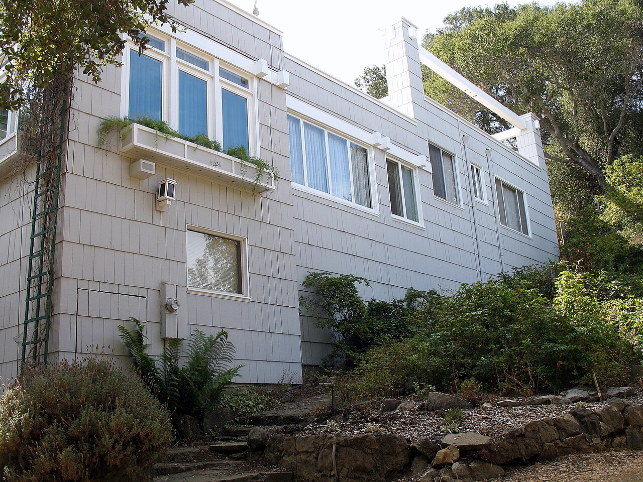
Fremont Older Open Space Preserve covers about 740 acres of hayfields, orchards, and oak-covered hills on the edge of Cupertino and Saratoga, reaching toward Mount Eden Road and Stevens Creek County Park. It is named for Fremont Older, a noted San Francisco newspaper editor who, with his wife Cora, owned part of the land for 60 years. Their home, "Woodhills," was once a gathering place for well-known figures of the day and is listed on the National Register of Historic Places; when Midpen bought the property in 1975, local publishers Mort and Elaine Levine leased and restored the house, which remains a private residence closed to the public.
The remaining hayfields and fruit trees date to 1910, when Maisie Garrod and her brother R.V. Garrod bought land here for pasture, orchards, and hay. Maisie's Peak, the preserve's highest point, is reached from the Prospect Road lot by the Cora Older, Seven Springs Loop, Hayfield, and Coyote Ridge trails, with sweeping views of the Santa Clara Valley. A popular 2.5-mile loop climbs the Cora Older Trail to the Seven Springs and Woodhills trails and the 900-foot hilltop of Hunters Point before returning on the Hayfield Trail.
Leashed dogs, bikes, and horses are allowed on designated trails; some trails close to bikes and horses in wet weather. The Prospect Road lot in Saratoga has 21 spaces, and more parking is available in adjacent Stevens Creek County Park.
Based on Fremont Older Open Space Preserve official information, checked Oct 15, 2026.
Know before you go
Fremont Older Open Space Preserve covers 732 acres near Cupertino in Santa Clara County. Closing follows the sun here: sunset at Fremont Older Open Space Preserve is around 4:51 p.m. in mid-December, 7:14 p.m. in mid-March, 8:29 p.m. in mid-June, and 7:18 p.m. in mid-September. 12 named trails add up to about 9.8 miles inside the park; the longest is Coyote Ridge Trail at 2.1 miles, and Seven Springs Loop Trail has the most up and down (about 619 feet). Mapped trails range from 495 to 1,151 feet in elevation. OpenStreetMap shows 2 parking areas, plus 1 restroom.
Facilities
- Restrooms
Facility details: official park information
Fremont Older Open Space Preserve at a glance
- PParking · 2
- WCRestrooms · 1
- Named trails · 11
© OpenStreetMap · CPAD · About this map
Trails
| Trail | Mapped length | Elevation | Surface & uses |
|---|---|---|---|
| Coyote Ridge Trail | 2.1 mi | 368 ft up & down905–1,151 ft | UnpavedBikesHorses |
| Seven Springs Loop Trail | 1.7 mi | 619 ft up & down539–891 ft | UnpavedBikesHorses |
| Toyon Trail | 1.3 mi | 588 ft up & down906–1,063 ft | UnpavedBikesHorsesNo bikes |
| Tony Look / Stevens Creek Trail | 0.8 mi | ||
| Hayfield Trail | 0.7 mi | 260 ft up & down825–1,027 ft | UnpavedBikesHorses |
| Bay View Trail | 0.6 mi | 125 ft up & down997–1,071 ft | BikesHorsesUnpaved |
| Vista Loop Trail | 0.5 mi | 159 ft up & down977–1,146 ft | BikesHorses |
| Ranch Road | 0.5 mi | 274 ft up & down495–801 ft | UnpavedNo bikesNo horsesBikesHorses |
| Rainbow Knoll Trail | 0.4 mi | 118 ft up & down754–841 ft | UnpavedBikesHorses |
| Wedding Trail | 0.4 mi | 105 ft up & down984–1,070 ft | UnpavedBikesHorses |
| Cora Older Trail | 0.4 mi | 159 ft up & down602–773 ft | BikesHorses |
| Woodhills Trail | 0.4 mi | 132 ft up & down797–933 ft | UnpavedBikesHorses |
Compared with nearby parks
Among the 22 other parks in this guide within 10 miles, Fremont Older Open Space Preserve is number 12 of 23 by size at 732 acres. 7 nearby parks have more mapped trail mileage than its 9.8 miles.
Closest places for what Fremont Older Open Space Preserve doesn't list:
- Off-Leash Area: Los Gatos Creek County Park (6.2 mi)
- Playground: Vasona Lake County Park (6.2 mi)
- Camping: Stevens Creek County Park (1.4 mi)
Rules & reservations
Official park page- Dogs
Leash 6 feet or shorter; dogs are not allowed in any Midpen water areas (district rules). Source
Open a half-hour before sunrise until a half-hour after sunset.
Map & directions
Nearby parks
Straight-line distanceContinue exploring
Santa Clara County parks Parks in CupertinoSources & verification
Last verified: Oct 15, 2026- California Protected Areas Database (CPAD) 2026aname, county, agency, access, acres
- Midpen preserve pageofficial_url, hours, hours_note, dogs, facilities.restrooms, description
- Midpen visitor FAQ (no entry or parking fees)fees
- Midpen dog access rulesdogs
- OpenStreetMap facilities and trailstrails
- U.S. Census Bureau place boundaries (nearest place)city
- OpenStreetMap: parking, restrooms, water, trailheads, trail lines, and bus stopsvisit
- Terrain Tiles elevation (USGS 3DEP), sampled every 20 m along OpenStreetMap trail linestrails.elevation
- Official park page (summarized in our words)narrative
- Official park page (introduction excerpt)intro