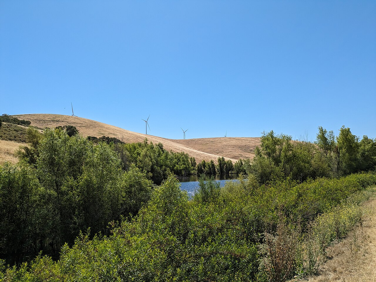
Brushy Peak Regional Preserve
Livermore, Alameda County, CA
- Size
- 1,768 acres Source
- Managed by
- East Bay Regional Park District
About Brushy Peak Regional Preserve
Brushy Peak rises to 1,702 feet where the Bay Area, the Delta, and the Central Valley meet. For generations of native Californians it was a sacred place at the center of trade routes linking Ohlone, Bay Miwok, and Northern Valley Yokuts peoples, and the Ssaoam tribelet hosted trade feasts nearby. Later its rock outcrops sheltered Gold Rush–era bandits, ranch families held picnics and dances among the rocks, and the Livermore Area Recreation and Park District began acquiring the land in the 1990s before teaming up with the East Bay Regional Park District.
The trails are used for hiking, biking, running, and dog walking, and dogs must stay on leash at all times to protect the preserve's fragile habitat. Grassland dominates, and ground squirrel burrows shelter burrowing owls, badgers, and San Joaquin kit foxes while red-tailed hawks and golden eagles hunt overhead. Old ranch ponds support California red-legged frogs and California tiger salamanders, and spring brings buttercups, lupine, and blue-eyed grass.
There is no drinking water, so bring your own. The summit and the northern section are open only on guided tours arranged through LARPD. The Laughlin Ranch staging area, at the end of Laughlin Road (from I-580 take Vasco Road north, then Northfront Road), has wheelchair-accessible parking and a restroom.
Based on Brushy Peak Regional Preserve official information, checked Oct 15, 2026.
Know before you go
Brushy Peak Regional Preserve covers 1,768 acres in Livermore, Alameda County. 5 named trails add up to about 9.6 miles inside the park; the longest is Brushy Peak Loop Trail at 3.4 miles, and Laughlin Loop Trail has the most up and down (about 782 feet). Mapped trails range from 598 to 1,076 feet in elevation. OpenStreetMap shows 1 parking area, including Laughlin Ranch Staging Area, plus 1 restroom and 1 drinking fountain.
Facilities
- Drinking Water
- Restrooms
Facility details: OpenStreetMap
Brushy Peak Regional Preserve at a glance
- PParking · 1: Laughlin Ranch Staging Area
- WCRestrooms · 1
- WDrinking water · 1
- Named trails · 5
© OpenStreetMap · CPAD · About this map
Trails
| Trail | Mapped length | Elevation | Surface & uses |
|---|---|---|---|
| Brushy Peak Loop Trail | 3.4 mi | 403 ft up & down629–1,076 ft | UnpavedBikesHorses |
| West Side Loop Trail | 2.1 mi | 620 ft up & down617–1,029 ft | UnpavedBikesHorses |
| Laughlin Loop Trail | 2.1 mi | 782 ft up & down635–1,054 ft | UnpavedBikesHorses |
| Dyer Ranch Trail | 1.1 mi | 300 ft up & down598–902 ft | UnpavedBikesHorses |
| Tamcan Trail | 0.9 mi | 387 ft up & down727–965 ft | UnpavedBikesHorses |
Compared with nearby parks
Among the 9 other parks in this guide within 10 miles, Brushy Peak Regional Preserve is number 3 of 10 by size at 1,768 acres. 2 nearby parks have more mapped trail mileage than its 9.6 miles.
Closest places for what Brushy Peak Regional Preserve doesn't list:
- Off-Leash Area: Bruno Canziani Park (6.6 mi)
- Playground: Robert Livermore Park (6.3 mi)
- Camping: Round Valley Regional Preserve (7.1 mi)
Rules & reservations
Official park page- Dogs
At Brushy Peak Regional Preserve: leash in developed areas, under the East Bay Regional Park District dog rules. Source
- Drinking water
No drinking water is available in the preserve; bring your own. Source
Gate hours change through the year; check the posted schedule.
Map & directions
North end of Laughlin Road, Livermore, CA
Nearby parks
Straight-line distanceContinue exploring
Alameda County parks Parks in LivermoreSources & verification
Last verified: Oct 15, 2026- California Protected Areas Database (CPAD) 2026aname, county, agency, access, acres
- East Bay Regional Park District dog rulesdogs
- East Bay Regional Park District park pageofficial_url, hours, address, description, fees
- OpenStreetMap facilities and trailsfacilities.drinking-water, facilities.restrooms, trails
- U.S. Census Bureau place boundaries (nearest place)city
- OpenStreetMap: parking, restrooms, water, trailheads, trail lines, and bus stopsvisit
- Terrain Tiles elevation (USGS 3DEP), sampled every 20 m along OpenStreetMap trail linestrails.elevation
- Official park page (summarized in our words)narrative
- Official park page (introduction excerpt)intro