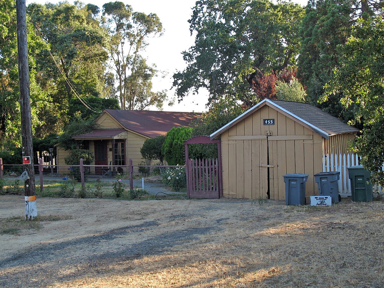
Hagemann Park
Livermore, Alameda County, CA
- Size
- 8 acres Source
About Hagemann Park
Hagemann Park sits on land with one of the longest recorded histories in Livermore. It was once a major pasture for the Mission of San Jose and became public land in 1835. Juan Pablo Bernal bought it in 1848, Martin Mendenhall was living there by 1852, and in 1892 it was sold to August Hagemann, who leased it to H.O. Ruter until the Herbert Hagemann family moved onto the property in 1916.
The house on the site dates to 1848 and is the oldest in Livermore. It was first built for the workers who rode the range and herded cattle. From the 1860s into the 1870s a brickyard operated on the slopes of the hill. The park itself was first built in 1983.
Today it is a neighborhood park with a picnic area that can be reserved, a play structure, and a multi-use sports field that is rented out from March through November.
Based on Hagemann Park official information, checked Oct 16, 2026.
Know before you go
Hagemann Park covers 8 acres in Livermore, Alameda County. The closest mapped bus stop is East Stanley Boulevard & El Caminito (routes 10R), about 1000 feet from the park.
Facilities
- BBQ Grills
- Picnic Area
- Playground
- Historic Site
Facility details: OpenStreetMap, official park information
Getting to Hagemann Park by bus
- East Stanley Boulevard & El Caminito · Routes 10R · 1000 ft from the park
- East Stanley Boulevard & Wall Street · Routes 10R · 1290 ft from the park
Stops within a quarter mile of Hagemann Park; confirm times with the transit agency.
Compared with nearby parks
Among the 11 other parks in this guide within 10 miles, Hagemann Park is the smallest at 8 acres.
Closest places for what Hagemann Park doesn't list:
- Off-Leash Area: Robertson Park (2.2 mi)
- Swimming: Shadow Cliffs Regional Recreation Area (2.7 mi)
- Camping: Del Valle Regional Park (7.7 mi)
Rules & reservations
Official park pageMap & directions
459 Olivina Avenue, Livermore, CA
Nearby parks
Straight-line distanceContinue exploring
Alameda County parks Parks in Livermore PlaygroundsSources & verification
Last verified: Oct 16, 2026- California Protected Areas Database (CPAD) 2026aname, county, agency, access, acres
- LARPD park pageofficial_url, address, description, facilities.picnic-area, facilities.playground, facilities.historic-site
- OpenStreetMap facilities and trailsfacilities.bbq-grills
- U.S. Census Bureau place boundariescity
- Official park page (checked for dog and fee information)unstated.dogs, unstated.fees
- OpenStreetMap: parking, restrooms, water, trailheads, trail lines, and bus stopsvisit
- Official park page (summarized in our words)narrative
- Official park page (introduction excerpt)intro