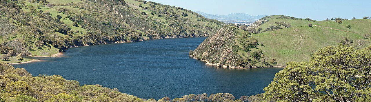
Del Valle Regional Park
Livermore, Alameda County, CA
- Size
- 4,395 acres Source
- Swimming
- Designated beaches Source
- Managed by
- East Bay Regional Park District
About Del Valle Regional Park
A reservoir with swimming beaches, picnic areas, camping, and trails in the Diablo Range. Source
Deep in a valley framed by oak-covered hills, with sailboats and sailboards skimming over its waters, Del Valle is like a lakeside resort only 10 miles south of Livermore.
Know before you go
Del Valle Regional Park covers 4,395 acres in Livermore, Alameda County. OpenStreetMap shows 15 parking areas, plus 15 restrooms and 2 drinking fountains.
Facilities
- Picnic Area
- Camping
- Boat Launch
- Fishing
- Swimming
- Restrooms
Facility details: official park information
Del Valle Regional Park at a glance
- PParking · 15
- WCRestrooms · 15
- WDrinking water · 2
© OpenStreetMap · CPAD · About this map
Trails
| Trail | Use |
|---|---|
| Ohlone Wilderness Trail | Permit required |
Compared with nearby parks
Among the 10 other parks in this guide within 10 miles, Del Valle Regional Park is number 3 of 11 by size at 4,395 acres. It is the only one of them with fishing.
Closest places for what Del Valle Regional Park doesn't list:
- Off-Leash Area: Bruno Canziani Park (5.5 mi)
- Playground: Bruno Canziani Park (5.5 mi)
- Tennis Courts: Robertson Park (5.8 mi)
Activities
- Swimming
- Designated East and West beaches; current conditions and seasonal lifeguard schedules apply.
- Camping
- Family and group campsites.
Rules & reservations
Official park page- Seasonal parking
The April–Labor Day weekend/holiday flat fee includes parking and launch fees; inspections and fishing permits are separate. Source
October: 6 a.m.–7 p.m.; other months vary. Check the official schedule.
Visit official reservationsMap & directions
7000 Del Valle Road, Livermore, CA 94550
Nearby parks
Straight-line distanceContinue exploring
Alameda County parks Parks in LivermoreSources & verification
Last verified: Oct 14, 2026- East Bay Regional Park Districtname, county, city, agency, access, acres, hours, hours_note, fees.parking, swimming, facilities, trails, activities, rules, alerts, address, reservations_url, description
- OpenStreetMap address locationcentroid
- OpenStreetMap: parking, restrooms, water, trailheads, trail lines, and bus stopsvisit
- Official park page (introduction excerpt)intro