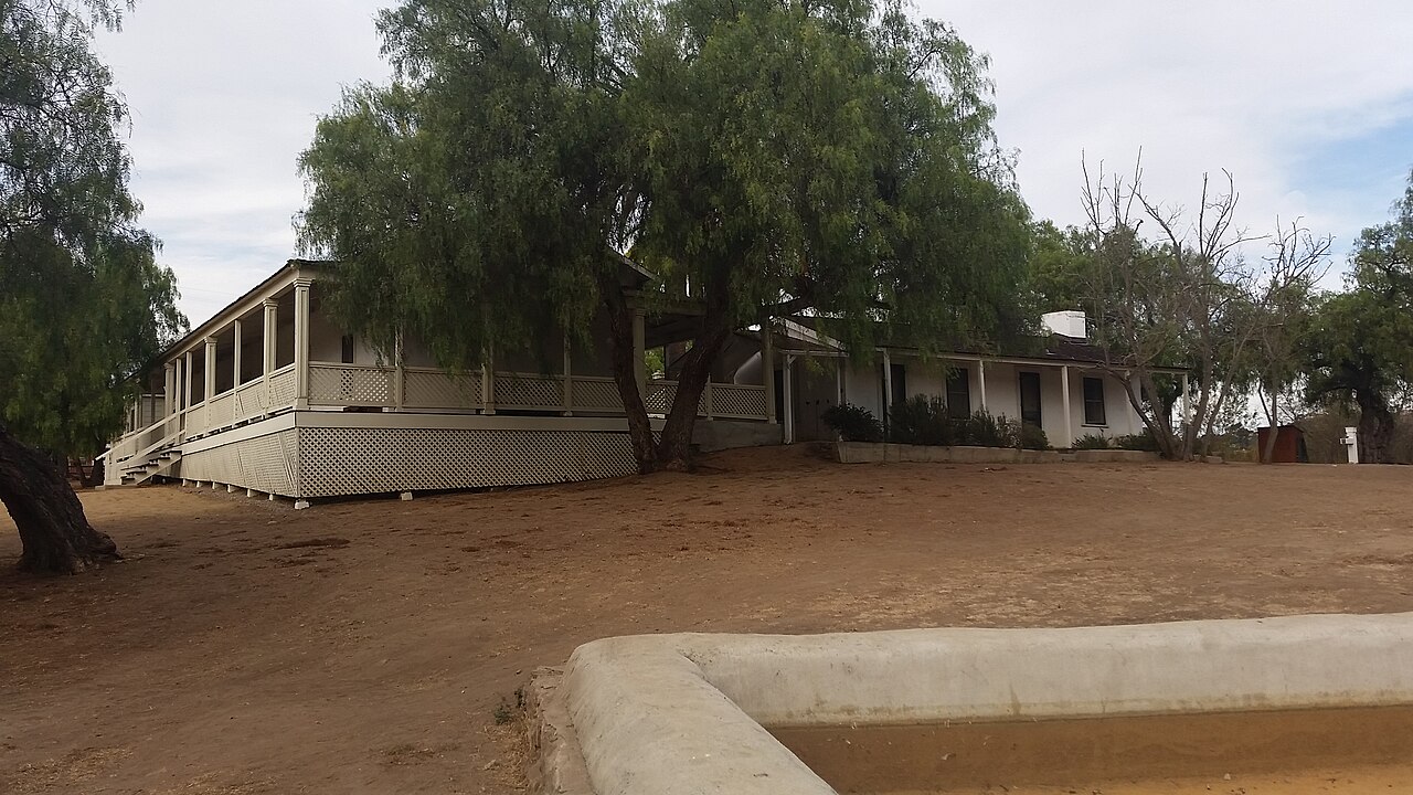
Los Peñasquitos Canyon Preserve
San Diego, San Diego County, CA
- Size
- 254 acres Source
- Managed by
- San Diego County Parks and Recreation
About Los Peñasquitos Canyon Preserve
Los Peñasquitos Canyon Preserve is managed jointly by the County and City of San Diego. Trails run along both sides of a creek that feeds a dense grove of riparian plants and trees, and native chaparral fills the land beyond, right up to the edge of suburban development. Hikers, cyclists, and equestrians use it all year.
Single-track trails near the creek are shaded almost the whole way, while a wider, sunnier trail and access road run farther out. In spring a waterfall may be flowing at the west end of the preserve, where the paths meet. The preserve has about 12 miles of trails, and they connect to a historic adobe ranch house with a museum, a community garden, and a small collection of farm animals; the ranch house is also used for weddings and special events. Visitors are asked to follow the signs and stay on designated paths to support restoration.
The staging area on Black Mountain Road is open for both vehicle and equestrian parking. Hours are 8 a.m. to sunset, with pedestrian access from sunrise to sunset. There is no public vehicle access and restrooms are closed on December 25.
Based on Los Peñasquitos Canyon Preserve official information, checked Oct 17, 2026.
Know before you go
Los Peñasquitos Canyon Preserve covers 254 acres in San Diego, San Diego County. Closing follows the sun here: sunset at Los Peñasquitos Canyon Preserve is around 4:43 p.m. in mid-December, 6:55 p.m. in mid-March, 7:57 p.m. in mid-June, and 6:56 p.m. in mid-September. 2 named trails add up to about 0.8 miles inside the park; the longest is San Diego Sea to Sea Trail at 0.7 miles, and San Diego Sea to Sea Trail has the most up and down (about 33 feet). Mapped trails range from 216 to 248 feet in elevation. OpenStreetMap shows 2 parking areas, plus 1 restroom and 1 drinking fountain.
Facilities
- Drinking Water
- Historic Site
- Restrooms
Facility details: OpenStreetMap
Los Peñasquitos Canyon Preserve at a glance
- PParking · 2
- WCRestrooms · 1
- WDrinking water · 1
- Named trails · 1
© OpenStreetMap · CPAD · About this map
Trails
| Trail | Mapped length | Elevation | Surface & uses |
|---|---|---|---|
| San Diego Sea to Sea Trail | 0.7 mi | 33 ft up & down216–248 ft | UnpavedBikes |
| Bowtie Rim Trail | 0.1 mi |
Compared with nearby parks
Among the 5 other parks in this guide within 10 miles, Los Peñasquitos Canyon Preserve is number 2 of 6 by size at 254 acres. It has the most mapped trail mileage of the group (about 0.8 miles).
Closest places for what Los Peñasquitos Canyon Preserve doesn't list:
- Playground: 4S Ranch Sports Park (4.7 mi)
- Tennis Courts: 4S Ranch Sports Park (4.7 mi)
Rules & reservations
Official park page- Dogs
At Los Peñasquitos Canyon Preserve: 6-ft leash rule, under the San Diego County Parks FAQ. Source
- Fees
Los Peñasquitos Canyon Preserve's official page does not mention an entry or parking fee; confirm with San Diego County Parks and Recreation. Source
Pedestrian access is available from sunrise to sunset; no vehicle access or restrooms on December 25.
Map & directions
12020 Black Mountain Road, San Diego, CA 92129
Nearby parks
Straight-line distanceContinue exploring
San Diego County parksSources & verification
Last verified: Oct 15, 2026- California Protected Areas Database (CPAD) 2026aname, county, agency, access, acres
- San Diego County Parks park page (read in a browser)official_url, hours, hours_note, address, description
- San Diego County Parks FAQ (dogs in County parks)dogs
- OpenStreetMap facilities and trailsfacilities.drinking-water, facilities.historic-site, facilities.restrooms, trails
- U.S. Census Bureau place boundariescity
- Official park page (checked for dog and fee information)unstated.fees
- OpenStreetMap: parking, restrooms, water, trailheads, trail lines, and bus stopsvisit
- Terrain Tiles elevation (USGS 3DEP), sampled every 20 m along OpenStreetMap trail linestrails.elevation
- Official park page (summarized in our words)narrative