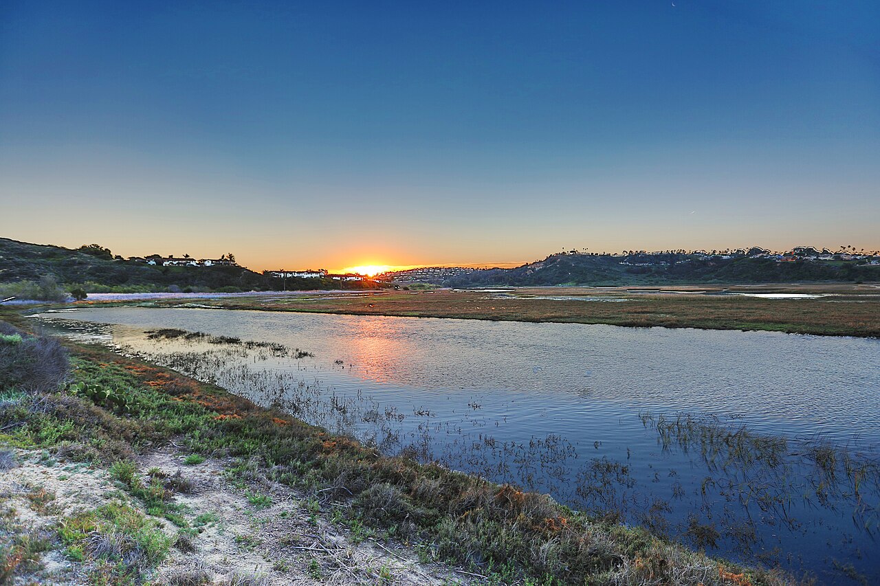
San Elijo Lagoon Ecological Reserve
Encinitas, San Diego County, CA
- Size
- 16 acres Source
- Managed by
- San Diego County Parks and Recreation
About San Elijo Lagoon Ecological Reserve
San Elijo Lagoon Ecological Reserve is one of the largest wetlands in San Diego, a mostly shallow-water estuary where Escondido and La Orilla Creeks meet the Pacific Ocean. People come to run, hike, watch birds, take photos, or paint, and the reserve also hosts weddings and special events.
About 7 miles of easy-to-moderate trails are open from sunrise to sunset, passing through salt marsh, freshwater habitat, and scrub. The quarter-mile Annie's Canyon Trail, which starts at 900 North Rios Avenue in Solana Beach, is a bit more demanding. Several other trailheads can be reached from Solana Beach neighborhoods. For children, TRACK Trails turns a walk into a nature scavenger hunt, with prizes claimed online.
The LEED Platinum-certified Nature Center at 2710 Manchester Avenue in Cardiff-by-the-Sea has exhibits on the reserve's history and on the plants and animals that live there, and it is a good place to plan a hike.
Twice a day the incoming tide covers much of the lagoon with salt water. As it goes out, it exposes mudflats full of invertebrates that feed shorebirds and ducks, while fresh water from creeks and storm drains mixes in. The plants and animals here are adapted to life where land meets ocean.
Based on San Elijo Lagoon Ecological Reserve official information, checked Oct 17, 2026.
Know before you go
San Elijo Lagoon Ecological Reserve covers 16 acres in Encinitas, San Diego County. Closing follows the sun here: sunset at San Elijo Lagoon Ecological Reserve is around 4:43 p.m. in mid-December, 6:56 p.m. in mid-March, 7:58 p.m. in mid-June, and 6:57 p.m. in mid-September. 2 named trails add up to about 0.6 miles inside the park; the longest is Nature Center Outer Loop at 0.5 miles, and Nature Center Outer Loop has the most up and down (about 18 feet). Mapped trails range from 12 to 22 feet in elevation. OpenStreetMap shows 2 parking areas, plus 1 restroom and 1 drinking fountain.
Facilities
- Drinking Water
- Restrooms
Facility details: OpenStreetMap
San Elijo Lagoon Ecological Reserve at a glance
- PParking · 2
- WCRestrooms · 1
- WDrinking water · 1
- Named trails · 2
© OpenStreetMap · CPAD · About this map
Trails
| Trail | Mapped length | Elevation | Surface & uses |
|---|---|---|---|
| Nature Center Outer Loop | 0.5 mi | 18 ft up & down12–22 ft | UnpavedNo horses |
| Nature Center Inner Loop | 0.1 mi | 3 ft up & down18–22 ft | UnpavedNo horses |
Compared with nearby parks
Among the 5 other parks in this guide within 10 miles, San Elijo Lagoon Ecological Reserve is the smallest at 16 acres. 1 nearby park has more mapped trail mileage than its 0.6 miles.
Closest places for what San Elijo Lagoon Ecological Reserve doesn't list:
- Playground: San Dieguito Park (2.4 mi)
- Tennis Courts: 4S Ranch Sports Park (8.9 mi)
Rules & reservations
Official park page- Dogs
At San Elijo Lagoon Ecological Reserve: 6-ft leash rule, under the San Diego County Parks FAQ. Source
- Fees
San Elijo Lagoon Ecological Reserve's official page does not mention an entry or parking fee; confirm with San Diego County Parks and Recreation. Source
Nature center 9 a.m. to 5 p.m. daily.
Map & directions
2710 Manchester Avenue, Cardiff-by-the-Sea, CA 92007
Nearby parks
Straight-line distanceContinue exploring
San Diego County parksSources & verification
Last verified: Oct 15, 2026- California Protected Areas Database (CPAD) 2026aname, county, agency, access, acres
- San Diego County Parks park page (read in a browser)official_url, hours, hours_note, address, description
- San Diego County Parks FAQ (dogs in County parks)dogs
- OpenStreetMap facilities and trailsfacilities.drinking-water, facilities.restrooms, trails
- U.S. Census Bureau place boundariescity
- Official park page (checked for dog and fee information)unstated.fees
- OpenStreetMap: parking, restrooms, water, trailheads, trail lines, and bus stopsvisit
- Terrain Tiles elevation (USGS 3DEP), sampled every 20 m along OpenStreetMap trail linestrails.elevation
- Official park page (summarized in our words)narrative
- Official park page (introduction excerpt)intro