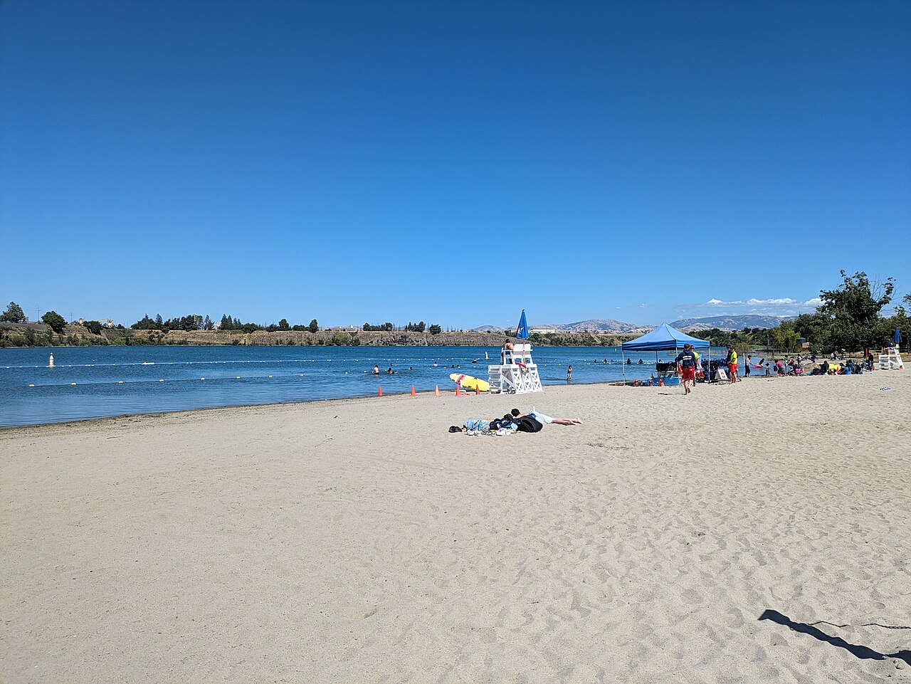
Shadow Cliffs Regional Recreation Area
Pleasanton, Alameda County, CA
- Size
- 259 acres Source
- Swimming
- Reopens in 2027 Source
- Managed by
- East Bay Regional Park District
About Shadow Cliffs Regional Recreation Area
Shadow Cliffs, about a mile from downtown Pleasanton on Stanley Boulevard, began as a gravel quarry that Kaiser Industries donated to the Park District; it opened as a park in 1971, and the land's value helped win a federal matching grant to develop it. Today the park centers on an 80-acre lake with a swimming beach, bathhouse, and refreshment stand, plus an arroyo with a chain of smaller lakes and shady ponds where swimming and boating are not allowed. The swim area is scheduled to reopen for the 2027 season and, when it is open, stops admitting new swimmers once it reaches capacity.
Trout and catfish are planted weekly in season, and anglers also catch bluegill and black bass; fishing requires both a state license and a daily District permit. Boats up to 17 feet with electric motors only may launch after a mandatory invasive-mussel inspection, and the marina building in the third parking lot rents watercraft and sells bait and snacks. Waterbirds gather in the quieter back lakes, and an interpretive pavilion completed in 2022, with a relief map of the park, marks the start of the Levee and Arroyo trails.
Solar carports installed in 2017 shade the parking lots and generate enough power to offset nearly all of the Park District's electricity use. The level, paved Lake Trail, an accessible fishing pier, and free beach wheelchairs make the park easy to visit for people with limited mobility. Alcohol is not allowed, and LAVTA WHEELS route 10 stops at the park daily.
Based on Shadow Cliffs Regional Recreation Area official information, checked Oct 15, 2026.
Know before you go
Shadow Cliffs Regional Recreation Area covers 259 acres in Pleasanton, Alameda County. 3 named trails add up to about 1.1 miles inside the park; the longest is South Arroyo Trail at 0.5 miles, and South Arroyo Trail has the most up and down (about 31 feet). Mapped trails range from 349 to 381 feet in elevation. OpenStreetMap shows 4 parking areas. The closest mapped bus stop is Shadow Cliffs Regional Recreation Area (routes 10R), at the park edge.
Facilities
- Boat Launch
- Picnic Area
- Swimming
Facility details: OpenStreetMap
Shadow Cliffs Regional Recreation Area at a glance
- PParking · 4
- Named trails · 3
© OpenStreetMap · CPAD · About this map
Trails
| Trail | Mapped length | Elevation | Surface & uses |
|---|---|---|---|
| South Arroyo Trail | 0.5 mi | 31 ft up & down352–374 ft | Unpaved |
| Lilienthal Road | 0.4 mi | 0 ft up & down380–381 ft | |
| North Arroyo Trail | 0.2 mi | 8 ft up & down349–360 ft | Unpaved |
Getting to Shadow Cliffs Regional Recreation Area by bus
- Shadow Cliffs Regional Recreation Area · Routes 10R · at the park edge
- Stanley Boulevard & Bernal Avenue · Routes 10R · 620 ft from the park
Stops within a quarter mile of Shadow Cliffs Regional Recreation Area; confirm times with the transit agency.
Compared with nearby parks
Among the 13 other parks in this guide within 10 miles, Shadow Cliffs Regional Recreation Area is number 8 of 14 by size at 259 acres. 7 nearby parks have more mapped trail mileage than its 1.1 miles.
Closest places for what Shadow Cliffs Regional Recreation Area doesn't list:
- Off-Leash Area: Robertson Park (4.7 mi)
- Playground: Hagemann Park (2.7 mi)
- Camping: Del Valle Regional Park (9.1 mi)
Rules & reservations
Official park page- Dogs
At Shadow Cliffs Regional Recreation Area: leash in developed areas, under the East Bay Regional Park District dog rules. Source
Gate hours change through the year; check the posted schedule.
Map & directions
2500 Stanley Boulevard, Pleasanton, CA 94566
Nearby parks
Straight-line distanceContinue exploring
Alameda County parksSources & verification
Last verified: Oct 15, 2026- California Protected Areas Database (CPAD) 2026aname, county, agency, access, acres
- East Bay Regional Park District dog rulesdogs
- East Bay Regional Park District park pageofficial_url, hours, address, description, fees, swimming
- OpenStreetMap facilities and trailsfacilities.boat-launch, facilities.picnic-area, facilities.swimming, trails
- U.S. Census Bureau place boundariescity
- OpenStreetMap: parking, restrooms, water, trailheads, trail lines, and bus stopsvisit
- Terrain Tiles elevation (USGS 3DEP), sampled every 20 m along OpenStreetMap trail linestrails.elevation
- Official park page (summarized in our words)narrative
- Official park page (introduction excerpt)intro