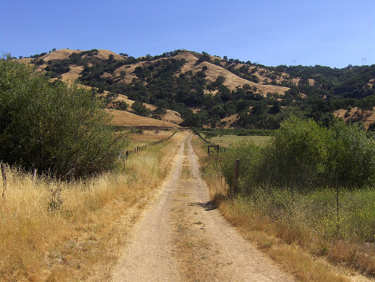
Joseph D. Grant County Park
San Jose, Santa Clara County, CA
- Size
- 10,882 acres Source
- Managed by
- Santa Clara County Parks
About Joseph D. Grant County Park
Joseph D. Grant County Park is Santa Clara County's largest regional park, covering 10,882 acres at the base of Mt. Hamilton. Its centerpiece, Halls Valley, lies between two ridges of the Diablo Range, and the terrain was shaped by movement along the still-active Calaveras Fault. Grasslands and oak woodland of blue, black, live, and valley oaks support more than 32 bird species and 39 mammal species. Cattle grazing is part of the park's history and is still used to manage some areas, and the park once hosted a successful program to increase Tule elk numbers. Spring brings wildflowers and running water.
A 51-mile trail system is open to hikers and equestrians, and mountain bikes are allowed on more than 75% of the trails. Dogs on a 6-foot leash may use the trails, picnic areas, and campgrounds. There are shaded first-come, first-served picnic areas, reservable group picnic and youth camping areas, and almost 40 reservable family campsites with hot showers for campers. One large lake and several smaller ponds offer warm-water fishing. Fires are allowed only in designated fire rings, and gathering wood is prohibited.
Agents of Discovery, a free mobile game in English and Spanish, starts near the historic ranch house and follows the Hotel and Snell trails for more than 1.5 miles. Up the mountain, Lick Observatory holds monthly concerts, lectures, and telescope viewings. The park is open from 8 a.m. to sunset, with vehicle entry fees year-round and additional fees for camping and group picnic areas. The Grant Lake entrance on Highway 130 has free parking.
Based on Joseph D. Grant County Park official information, checked Oct 18, 2026.
Know before you go
Joseph D. Grant County Park covers 10,882 acres in San Jose, Santa Clara County. Closing follows the sun here: sunset at Joseph D. Grant County Park is around 4:50 p.m. in mid-December, 7:13 p.m. in mid-March, 8:28 p.m. in mid-June, and 7:16 p.m. in mid-September. OpenStreetMap shows 8 parking areas, including Twin Gates Trailhead, plus 6 restrooms and 3 drinking fountains.
Facilities
- Picnic Area
- Camping
- Fishing
- Historic Site
Facility details: official park information
Joseph D. Grant County Park at a glance
- PParking · 8: Twin Gates Trailhead
- WCRestrooms · 6
- WDrinking water · 3
- iVisitor center · 1: Ranger Station
- Named trails · 2
© OpenStreetMap · CPAD · About this map
Trails
| Trail | Elevation | Surface & uses | Use |
|---|---|---|---|
| Hotel Trail | 1,186 ft up & down1,411–2,088 ft | UnpavedBikes | Walking |
| Snell Trail | 208 ft up & down1,494–1,575 ft | Walking |
Compared with nearby parks
Among the 3 other parks in this guide within 10 miles, Joseph D. Grant County Park is the largest at 10,882 acres. It is the only one of them with camping.
Closest places for what Joseph D. Grant County Park doesn't list:
- Off-Leash Area: Hellyer County Park (7.5 mi)
- Playground: Hellyer County Park (7.5 mi)
- Splash Pad: Hellyer County Park (7.5 mi)
Activities
- Camping
- Reservable family and group campsites.
- Hiking
- The official park page describes a 51-mile trail system.
Rules & reservations
Official park page- Dogs
Dogs on a six-foot leash are allowed on trails, picnic areas, and campgrounds. Source
- Campfires
Use designated fire rings only and follow posted restrictions; collecting firewood is prohibited. Source
Map & directions
18405 Mt. Hamilton Road, San Jose, CA 95140
Nearby parks
Straight-line distanceContinue exploring
Santa Clara County parks Parks in San JoseSources & verification
Last verified: Oct 14, 2026- Official park informationname, county, city, agency, access, acres, hours, dogs, facilities, trails, activities, rules, address, reservations_url, description
- Official vehicle fee schedulefees.parking
- OpenStreetMap address locationcentroid
- OpenStreetMap: parking, restrooms, water, trailheads, trail lines, and bus stopsvisit
- Terrain Tiles elevation (USGS 3DEP), sampled every 20 m along OpenStreetMap trail linestrails.elevation
- Official park page (summarized in our words)narrative